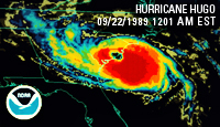
South Carolina HurricaneWatch
South Carolina Hurricane InformationIntroductionHurricane storm surge sensors. Click on icons for more information. Preventing flood hazards, such as the hurricane induced storm tide, from becoming human disasters requires an understanding of the relative risks floods pose to specific communities and knowledge of the processes by which flood waters rise, converge, and abate. Historically, hurricane-induced storm tides have been documented through measurement of high-water marks left on structures or vegetation. However, these sources are not always reliable or accurate and do not provide quantitative information about the timing of the flooding, the sequencing of multiple paths by which the storm-tide waters arrived, or the magnitude of waves comprising floodwaters. In response to these deficiencies, the U.S. Geological Survey South Atlantic Water Science Center (USGS-SAWSC), in cooperation with various municipal, State, and Federal cooperators, uses four monitoring approaches for measuring the timing, magnitude, and duration of hurricane storm-tide dynamics. Two approaches utilize a fixed network of gage locations and two approaches utilize the temporary deployment of water-level sensors. Real-Time Monitoring Network.")
Real-time gage for Atlantic Intracoastal Waterway at Highway 9 near Nixon Crossroad, SC (station 02110777). The USGS maintains a network of 47 real-time water-level and water-quality gages along the South Carolina coast. The gages record water level, specific conductance, temperature, and (or) dissolved oxygen at 15-minute intervals and are available on the web (sc.water.usgs.gov) with a maximum of a 1-hour time delay. The real-time network is maintained to monitor a large range of hydrologic conditions, from droughts to floods, and provide the data on the web for a broad base of stakeholders. In the event of a hurricane, the real-time network allows individuals to monitor the storm-tide data in near real time. Depending on the elevation of the gage house structure, the real-time gage may be at risk of being inundated by flood waters during extreme storm tide. Real-Time Rapid Deployment Gages
Temporary real-time storm-surge gage attached to a structure near the U.S. 17 bridge on the Waccamaw River near Georgetown, SC. During a hurricane, there also may be a need to collect additional real-time storm-tide data to assist emergency management agencies to monitor storms from remote locations and make critical public safety decisions. The fixed real-time coastal network may not provide complete coverage of the coast and there may be locations where a temporarily deployed real-time gage would fill data gaps. The general approach for the real-time rapid deployment gage is a pre-fabricated gage-in-a-box that can be quickly attached to a bridge rail with little or no modification to the bridge structure. The design uses a radar water-level sensor housed in a small aluminum shelter along with telemetry equipment, solar panel, and antenna. It is feasible that a crew in South Carolina could deploy 3 or 4 temporary real-time gages in a day prior to a storm. Hurricane Storm Surge NetworkIn addition to the real-time network, the USGS-SAWSC, in cooperation with the U.S. Army Corps of Engineers Charleston District and the South Carolina Department of Transportation, established a hurricane storm-tide monitoring network for South Carolina. The network is designed for a cost effective and time-efficient monitoring of hurricane storm tide and is only activated in the event of an approaching hurricane. Currently (2015), the hurricane storm-tide network consists of 72 sites distributed along the South Carolina coast. At each site, a bracket for a water-level sensor has been attached to a permanent structure, such as a bridge abutment or pier. In addition, some sites include a bracket for a barometric pressure sensor. The elevation of the water-level sensor bracket has been determined by differential leveling to a benchmark of known elevation. In the event of a storm, the sensors are attached to the bracket and the timing, duration, and magnitude of the storm tide is recorded. Upon retrieval of the sensors, the water-level data are easily adjusted to mean sea level because the bracket elevations were previously determined. The storm-tide data is then able to be quickly disseminated to interested agencies and coastal resource managers. Temporary Deployment of Hurricane Storm Surge Sensors
Deployment of a temporary hurricane storm-surge sensor. Deployment includes a metal pipe containing storm surge sensor strapped to a power pole. To augment the fixed location hurricane storm-tide and the real-time gaging networks, a temporary network of hurricane storm tide sensors can be deployed prior to a hurricane. As part of this monitoring approach, water-level and barometric-pressure sensors are deployed to areas of projected hurricane landfall. The addition of these sensors creates a concentrated network of storm-tide monitors which provide more spatially dense monitoring of hurricane storm tide. For example, temporary deployment of sensors in the projected hurricane path can be placed to monitor the escalation and attenuation of the hurricane tide along coastal rivers and across barrier islands, low-lying areas, and wetlands. After the passing of a storm, unlike the established hurricane storm-tide network, the locations of the temporarily deployed sensors must be surveyed to a known elevation. The USGS has successfully deployed temporary storm tide-networks for Hurricanes Rita (2005), Wilma (2005), Gustav (2008), Ike (2008), Irene (2011), Isaac (2012), Sandy (2013), and Tropical Storm Ernesto (2006). SummaryThe 119 monitoring sites for the two fixed networks, with the addition of temporarily deployed sites, provide a cost-effective hurricane storm-tide monitoring network for South Carolina. The combined networks effectively leverage resources of over 15 cooperative funding agencies in South Carolina for monitoring hurricane storm tide. The data will be a valuable resource for emergency preparedness agencies to better protect public safety, for engineers to improve structural design of coastal infrastructures, and for oceanographers to evaluate and improve hurricane storm-tide computer models. Hurricane Links
Hurricane Publications
Flood Information
Flood Links
|

![]() U.S. Department of the Interior |
U.S. Geological Survey
U.S. Department of the Interior |
U.S. Geological Survey
URL: http://sc.water.usgs.gov/hurricane/index.html
Page Contact Information: South Carolina Webmaster
Page Last Modified: Wednesday, 14-Dec-2016 09:29:44 EST