Santee River Basin Study
Project Maps and Spatial Data
THIS PROJECT HAS BEEN COMPLETED AND IS BEING ARCHIVED IN ITS FINAL CONFIGURATION
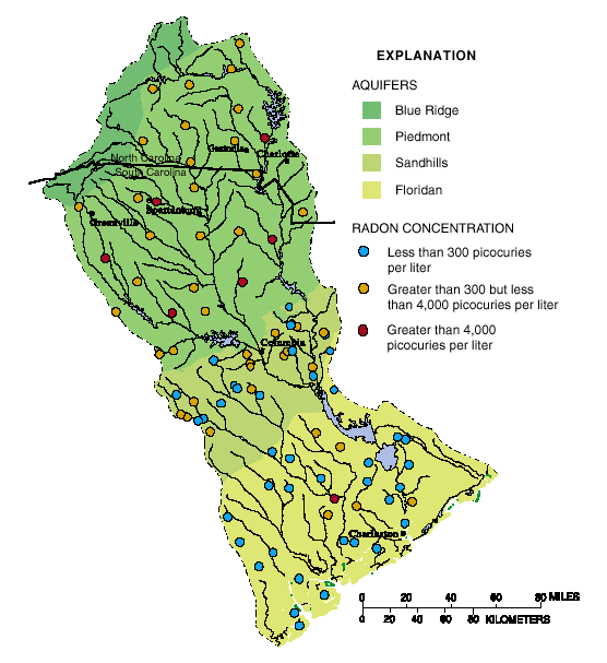
[an error occurred while processing this directive]Radon Concentration Map
Radon concentrations were highest in the Piedmont and Sandhills aquifers, resulting from naturally high levels of uranium in near-surface rocks and sediment.