Bridge Scour
Bridge Scour
Bridge Information View
Construction Information View
Theoretical Abutment Scour View
| Flow Index | Abutment Location | Blocked Flow | Blocked Area | Blocked Length | Avg Blocked Flow Depth | Avg Blocked Flow Velocity | Skew (degrees) | K1 | K2 | Scour depth, Froelich | Abutment type | M(g) |
|---|---|---|---|---|---|---|---|---|---|---|---|---|
| Q100 | left abutment | 539 | 629.2 | 88.6 | 7.1 | 0.9 | -8 | 0.55 | 0.99 | 11.6 | spill-through | 0.550 |
Field Information View
| Observation Location | Max scour depth incl infill, referenced from flood plain (ft) |
Infill at bottom of scour hole (ft) | Width of scour hole at low point (ft) | Length of scour hole (ft) | Bottom of scour hole D50, excluding infill (mm) |
Soil Type Scour | Formation | D50 hole |
|---|---|---|---|---|---|---|---|---|
| swampy channel | 13.7 | 0.9 | 100 | 120 | 0.439 | clay | yes | 0.151 |
Photos View
| Photo ID: 995 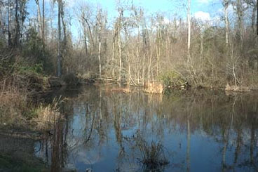
Caption: Downstream channel as viewed from the downstream face of structure 144026100100 on Route SC 261, crossing Sammy Swamp in Clarendon County, South Carolina (February 18,1997). |
Photo ID: 996 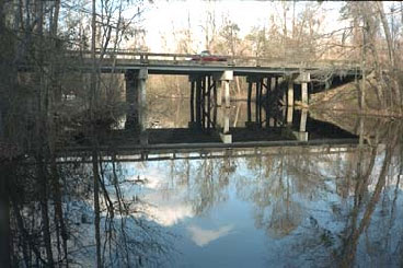
Caption: Upstream face of structure 144026100100 as viewed from upstream on Route SC 261, crossing Sammy Swamp in Clarendon County, South Carolina (February 18,1997). |
Photo ID: 997 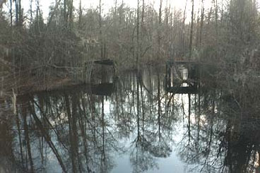
Caption: Upstream channel as viewed from upstream face of structure 144026100100 on Route SC 261, crossing Sammy Swamp in Clarendon County, South Carolina (February 18,1997). |
Photo ID: 998 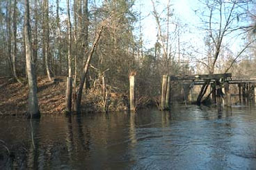
Caption: Old road embankment as viewed from upstream at structure 144026100100 on Route SC 261, crossing Sammy Swamp in Clarendon County, South Carolina (February 18,1997). |
Photo ID: 999 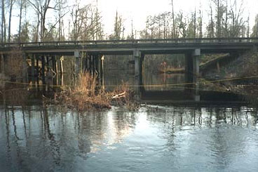
Caption: Downstream face of structure 144026100100 as viewed from downstream on Route SC 261, crossing Sammy Swamp in Clarendon County, South Carolina (February 18,1997). |
Scour Figures View
(click on the link below to view the diagram file,
not all bridges have a diagram)
Bridge Information View
Construction Information View
Pier Scour Data - Q100
Field Measurement of Clear-Water Pier Scour
Predicted Clear-Water Pier Scour for 100-Year Flow
Pier Scour Data - QHIS
Field Measurement of Clear-Water Pier Scour
Predicted Clear-Water Contraction Scour for Historical Flow
Contraction Scour Data - Q100
Field Measurement of Clear-Water Contraction Scour
Predicted Clear-Water Contraction Scour for Historical Flow
Contraction Scour Data - QHIS
Field Measurement of Clear-Water Contraction Scour
Predicted Clear-Water Contraction Scour for Historical Flow
Photos View
Photos View
Bridge Information View
Construction Information View
Pier Scour Data
Field Measurement of Live-Bed Pier Scour
| Survey Date | Pier Width | Multiple Column | Measured Scour | Bent No. | Pier Shape | No. of Columns | General Soil Type | Pier Material | Max Spacing | D50 |
|---|---|---|---|---|---|---|---|---|---|---|
| 3/15/2007 | 1.2 | yes | 2.1 | 4 | square | 7 | sand | concrete | 0.27 | |
| 3/15/2007 | 1.2 | yes | 2.1 | 3 | square | 7 | sand | concrete | 0.27 |
Predicted Live-Bed Pier Scour for Historical Flow
| Flow Index | K1 | Predicted Scour | Flow Depth | K2 | Pier Width | Flow Velocity | K3 | Pier Length | Froude No. | K4 | Pier Skew |
|---|---|---|---|---|---|---|---|---|---|---|---|
| Q100 | 1.1 | 3.7 | 6.8 | 1.00 | 1.20 | 6.2 | 1.1 | 8.8 | 0.42 | 1.0 | 0 |
| Q100 | 1.1 | 3.7 | 6.8 | 1.00 | 1.20 | 6.3 | 1.1 | 8.8 | 0.43 | 1.0 | 0 |
Contraction Scour Data
Field Measurement of Live-Bed Contraction Scour
| Survey Date | Measured Scour (Includes Infill) | General Soil Type | Location | Estimated Infill | D50 | Measured Scour (Worst Case) | Comments |
|---|---|---|---|---|---|---|---|
| 3/15/2007 | 6.9 | sand | downstream | 2.6 | 0.3 | 6.9 | |
| 3/15/2007 | 7.8 | sand | upstream | 4.6 | 0.3 | 7.8 | Scour at old bridge upstream of existing bridge. The hydraulics at the old bridge are not known. |
Predicted Live-Bed Contraction Scour for Historical Flow
| Flow Index | Approach Depth | Predicted Scour | Bridge Contraction Ratio | Approach Flow | Bridge Flow | Fall Velocity | Approach Width | Bridge Width | Energy Slope |
|---|---|---|---|---|---|---|---|---|---|
| Q100 | 11.7 | 8.4 | 0.9 | 1,549 | 3,181 | 0.1 | 63 | 70.2 | 0.0015 |
| 0.9 |
Photos View
| Photo ID: SAM_SWAMP_SC-261_0001 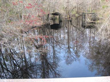
Caption: Upstream channel at structure 144026100100 on Route SC 261, crossing Sammy Swamp in Clarendon County, South Carolina (March 15, 2007). | Photo ID: SAM_SWAMP_SC-261_0002 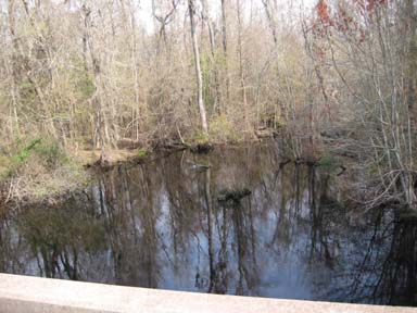
Caption: Downstream channel at structure 144026100100 on Route SC 261, crossing Sammy Swamp in Clarendon County, South Carolina (March 15, 2007). | Photo ID: SAM_SWAMP_SC-261_0003 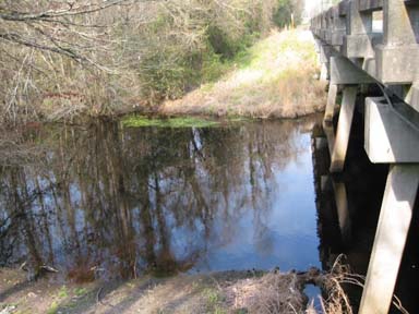
Caption: Upstream face viewed from right at structure 144026100100 on Route SC 261, crossing Sammy Swamp in Clarendon County, South Carolina (March 15, 2007). | Photo ID: SAM_SWAMP_SC-261_0004 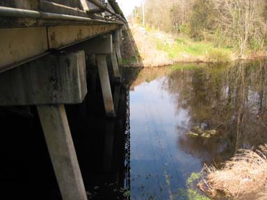
Caption: Downstream face viewed from right at structure 144026100100 on Route SC 261, crossing Sammy Swamp in Clarendon County, South Carolina (March 15, 2007). | Photo ID: SAM_SWAMP_SC-261_0005 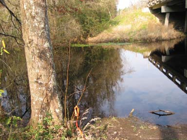
Caption: Cross section -25 viewed from right at structure 144026100100 on Route SC 261, crossing Sammy Swamp in Clarendon County, South Carolina (March 15, 2007). |
| Photo ID: SAM_SWAMP_SC-261_0006 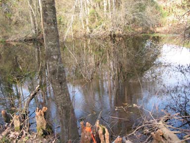
Caption: Cross section -50 viewed from right at structure 144026100100 on Route SC 261, crossing Sammy Swamp in Clarendon County, South Carolina (March 15, 2007). | Photo ID: SAM_SWAMP_SC-261_0007 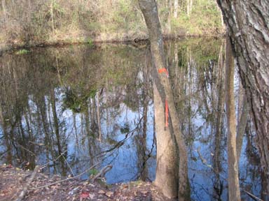
Caption: Cross section -100 viewed from right at structure 144026100100 on Route SC 261, crossing Sammy Swamp in Clarendon County, South Carolina (March 15, 2007). | Photo ID: SAM_SWAMP_SC-261_0008 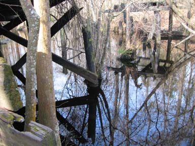
Caption: Cross section -150 viewed from right at structure 144026100100 on Route SC 261, crossing Sammy Swamp in Clarendon County, South Carolina (March 15, 2007). | Photo ID: SAM_SWAMP_SC-261_0009 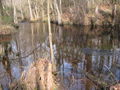
Caption: Cross section -200 viewed from right at structure 144026100100 on Route SC 261, crossing Sammy Swamp in Clarendon County, South Carolina (March 15, 2007). | Photo ID: SAM_SWAMP_SC-261_0010 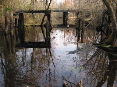
Caption: Structure 144026100100 on Route SC 261, crossing Sammy Swamp in Clarendon County, South Carolina as viewed from upstream (March 15, 2007). |
| Photo ID: SAM_SWAMP_SC-261_0011 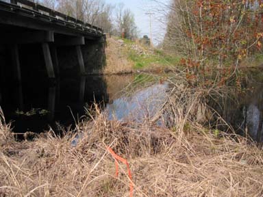
Caption: Cross section +25 (right to left) at structure 144026100100 on Route SC 261, crossing Sammy Swamp in Clarendon County, South Carolina (March 15, 2007). | Photo ID: SAM_SWAMP_SC-261_0012 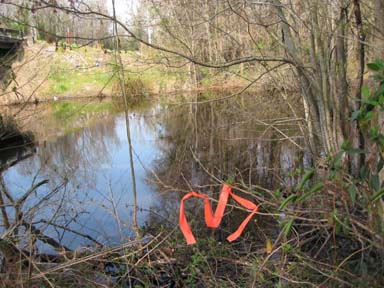
Caption: Cross section +50 (right to left) at structure 144026100100 on Route SC 261, crossing Sammy Swamp in Clarendon County, South Carolina (March 15, 2007). | Photo ID: SAM_SWAMP_SC-261_0013 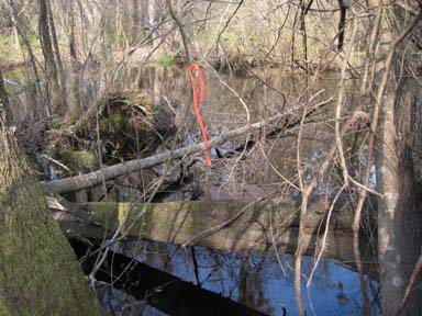
Caption: Cross section +100 (right to left) at structure 144026100100 on Route SC 261, crossing Sammy Swamp in Clarendon County, South Carolina (March 15, 2007). | Photo ID: SAM_SWAMP_SC-261_0014 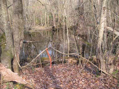
Caption: Cross section +150 (right to left) at structure 144026100100 on Route SC 261, crossing Sammy Swamp in Clarendon County, South Carolina (March 15, 2007). | Photo ID: SAM_SWAMP_SC-261_0015 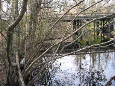
Caption: Structure 144026100100 on Route SC 261, crossing Sammy Swamp in Clarendon County, South Carolina as viewed from downstream (March 15, 2007). |
| Photo ID: SAM_SWAMP_SC-261_0016 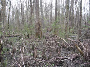
Caption: Upstream right floodplain at structure 144026100100 on Route SC 261, crossing Sammy Swamp in Clarendon County, South Carolina (March 15, 2007). | Photo ID: SAM_SWAMP_SC-261_0017 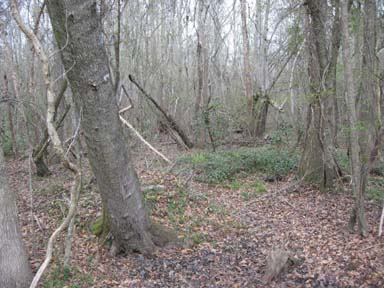
Caption: Downstream right floodplain at structure 144026100100 on Route SC 261, crossing Sammy Swamp in Clarendon County, South Carolina (March 15, 2007). | Photo ID: SAM_SWAMP_SC-261_0019 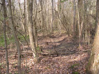
Caption: Downstream left floodplain at structure 144026100100 on Route SC 261, crossing Sammy Swamp in Clarendon County, South Carolina (March 15, 2007). | Photo ID: SAM_SWAMP_SC-261_0021 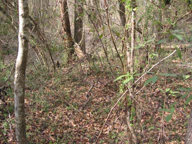
Caption: Upstream left floodplain at structure 144026100100 on Route SC 261, crossing Sammy Swamp in Clarendon County, South Carolina (March 15, 2007). |
Citations:
Benedict, S.T., and Caldwell, A.W., 2009, Development and evaluation of live-bed pier- and contraction-scour envelope curves in the Coastal Plain and Piedmont Provinces of South Carolina: U.S. Geological Survey Scientific Investigations Report 2009–5099, 108 p.
Benedict, S.T., 2016, Clear-water abutment and contraction scour in the Coastal Plain and Piedmont Provinces of South Carolina, 1996-99: U.S. Geological Survey Water Resources Investigation Report 2003-4064,https://pubs.er.usgs.gov/publication/wri034064.
Benedict, S.T., and Caldwell, A.W., 2016. Development and evaluation of clear-water pier and contraction scour envelope curves in the Coastal Plain and Piedmont Provinces of South Carolina (ver. 1.1, August 2016): U.S. Geological Survey Scientific Investigations Report 2005–5289, 98 p.
USGS - South Atlantic Water Science Center